

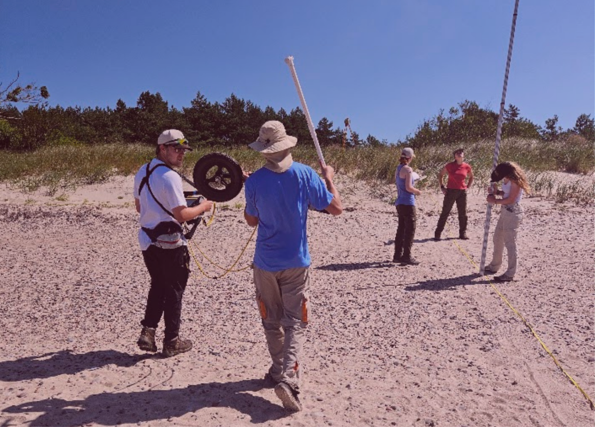
How did the Baltic Sea coast respond to the most powerful storms of the 20th century, and what can the traces they left behind reveal about future threats? Scientists from the United States , together with Donatas Pupienis, a professor at Vilnius University's Faculty of Chemistry and Geosciences, are seeking answers to these questions. In mid-July this year, they carried out detailed geophysical, geological, and morphometric surveys along the stretch of Baltic coast between Šventoji and the Latvian settlement of Nida to determine whether traces of 20th-century hurricane-force storms remain in the coastal sediments. The research team included Philip Reeder a professor at Duquesne University , Harry Jol, a professor at the University of Wisconsin–Eau Claire , geospatial technology coordinator Martin Goettl, students Brock Johnson, Gracie Sime, Megan Doles, Grace Schmidt, and Gavin Comiskey, and professor D. Pupienis.
The scientists used ground-penetrating radar (GPR) – a geophysical instrument for non-invasive subsurface investigation – with 100 and 500 MHz antennas, and drilled shallow boreholes 1–2.5 m deep to detect traces of 20th-century hurricane-force storms. They looked for sediment layers that could have formed after the storms that battered the Baltic coast on October 18, 1967, January 14, 1993, and December 4, 1999. Such deposits could have accumulated when storm-driven water flowed through gaps in the foredune.
Written sources indicate that residents and fishermen along the Lithuanian and Latvian coasts suffered heavy losses during these hurricane-force storms: buildings were washed away, a bridge and sluices were destroyed, and ships were damaged beyond repair. During the 1967 storm, Lake Papė merged with the Baltic Sea. In the northern part of Šventoji, a house standing about 50 m from the shore was washed away at the site of a breach. During the 1993 storm, homesteads were flooded, and in some places the water level reached about one meter.
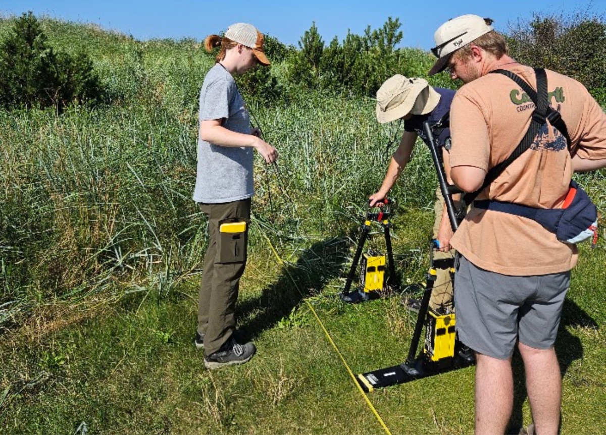
University of Wisconsin–Eau Claire students conducting geophysical surveys. Photo by Prof. Donatas Pupienis.
Why were the storms of 1967, 1993, and 1999 selected?
These storms were not chosen at random. First, they were among the strongest 20th-century storms and had the greatest impact on the Lithuanian and Latvian coasts. Second, these storms are known to have breached or even washed away the foredune. Traces of these extreme events may have survived in the coastal sediments, which is why they were selected for more detailed study.
The most powerful storm raged on October 18, 1967. Southwesterly wind speeds reached 34–40 m/s, with gusts up to 50 m/s. Sea level rose to an unprecedented 185 cm above the long-term mean. The storm severely eroded the coast, flooded coastal areas, and created breaches in the foredune.
Storm "Verena" hit the Baltic coast on January 14, 1993. Southwesterly winds reached about 20 m/s, and sea level rose to 115 cm.
On December 4, 1999, an extreme storm named "Anatol" struck the Lithuanian coast. It brought southwesterly and west-southwesterly winds with gusts reaching 40.5 m/s. Sea level rose to 165 cm. The largest volumes of eroded sediment on the Lithuanian coast were recorded following the two strongest 20th-century storms – October 18, 1967, and December 4, 1999.
Initial results reveal a new hypothesis
Initial results revealed that in the surveyed coastal section contains a peat layer at a depth of 2–2.5 m, covered by aeolian sand deposits. Whether storm-formed sediment layers have been survived in this section will be determined through detailed laboratory analyses of the sediments’ grain-size distribution and heavy minerals composition .
A preliminary cross-sectional profile of the coast in the northern part of the Šventoji was obtained using a 500 MHz ground-penetrating radar antenna. This method allows researchers to examine the internal structure of the foredune to a depth of about 3.5 m.
The radar image shows how the foredune formed and changed over time. It grew upward as wind-blown and sand accumulated, and gradually expanded seaward. Layers left by wave erosion can also be identified. On the right side of the profile, the radar signal weakens because it is attenuated by the saline Baltic Sea water.
On the left side of the profile, between approximately 0–12 m , landward-dipping layers about 1 meter thick tilted toward land are visible. These may have formed as the dunes migrated landward, though sea-level fluctuations may also have influenced their formation. The study led a new and particularly interesting hypothesis: these layers could be part of an ancient barrier spit.
Between approximately 0–22 meter section of the profile, peat layers were also found at a depth of about 1.5 meters. Their age has been linked to the Littorina Sea period, approximately 3320–2420 BC.

Preliminary 500 MHz ground-penetrating radar profile from the northern part of the Šventoji settlement. The image shows the foredune stratigraphy to a depth of 3.5 m. However, it presents unprocessed survey data.
Why is this research important today?
Studies of hurricane-force storms help us understand how the Baltic Sea coast responded to extreme natural events in the past. Determining the extent of sediment layers left by storms makes it possible to assess the scale of past flooding, identify locations where water breached the foredune, and pinpoint the most vulnerable coastal sections.
In the future, this knowledge could be used to create storm-surge and storm-risk maps, guide land-use and infrastructure planning, select appropriate coastal management and civil protection measures, and refine models for forecasting extreme events. This is especially important as sea levels rise, since storms of similar strength could cause greater coastal flooding, shoreline erosion, and infrastructure damage.
Sediment layers formed by 20th-century hurricane-force storms, if found, would provide new insights into areas flooded in the past. The research results would also help identify potentially hazardous low-lying areas of the Baltic coast and forecast the risks they may face from increasingly frequent and intense storms in the 21st century.
A long-standing US–Lithuanian scientific collaboration
The collaboration between D. Pupienis, a professor VU Faculty of Chemistry and Geosciences, and H. M. Jol, a professor at the University of Wisconsin–Eau Claire, began in Vilnius in 2017. H. M. Jol learned from Ilya Buynevich, an associate professor at Temple University, about the coastal research being carried out by VU scientists on the Baltic Sea.
The scientists were brought together by a shared goal of gaining a deeper understanding of the structure, evolution, and dynamics of the foredunes along the Lithuanian and Latvian Baltic coasts, as well as the dunes of the Curonian Spit. Since 2017, the teams have conducted joint research and collected high-resolution geophysical, topographic, and sedimentological data.
This is a long-term US–Lithuanian scientific collaboration initiative. Students from the University of Wisconsin–Eau Claire and Vilnius University are involved in the research. They take part in fieldwork, analyze the collected data, and help present the research results. The researchers plan to continue collaboration in the coming years.
The research is being carried out as part of the project "Subsurface Imaging of Holocaust Sites and Coastal Environments: Latvia and Lithuania."
The project is funded through the University of Wisconsin–Eau Claire's Blugold Commitment student program, under the Student-Faculty International Fellows Program for Research, Service, and Creative Activity. The project is also supported by the L. E. Phillips Family Foundation, Jeff Liddicoat, and anonymous community donors.
What comes next?
In the next stage, the collected data will be processed, analyzed, and interpreted. Researchers will correlate the radar images with local topography, analyze coastal morphometric measurements from previous years, and conduct grain-size and heavy mineral analyses of the deposits.
By comparing the geophysical, geological, and morphometric data, the researchers aim to determine whether traces of specific 20th-century hurricane-force storms have survived in the coastal sediments, and to assess the scale of past flooding.
Initial results are expected to be presented at the upcoming Geological Society of America conference in the United States. Final conclusions will be presented once the laboratory analyses are completed and all collected data have been interpreted.